File:Gdansk Bay Details 1939 german.png
Jump to navigation
Jump to search

Size of this preview: 800 × 576 pixels. Other resolutions: 320 × 230 pixels | 640 × 460 pixels | 1,024 × 737 pixels | 1,280 × 921 pixels | 1,668 × 1,200 pixels.
Original file (1,668 × 1,200 pixels, file size: 39 KB, MIME type: image/png)
Captions
Captions
Add a one-line explanation of what this file represents
Summary
[edit]
| Description |
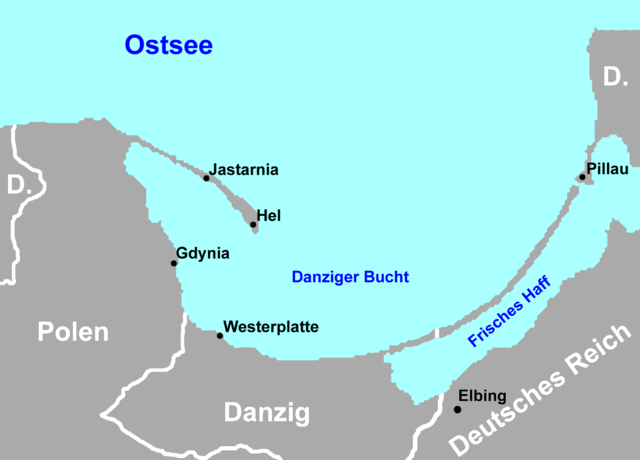
English: Map of the Gdańsk Bay in 1939. The Memel Territory was retransfered from Lithuania to Germany in March
1939.
Deutsch: Karte der Danziger Bucht mit den Grenzen von 1939. Das Memelland ging im März 1939 von Litauen zurück an das Deutsche Reich |
| Date | 18 March 2007 (original upload date) |
| Source | No machine-readable source provided. Own work assumed (based on copyright claims). |
| Author | No machine-readable author provided. Masturbius assumed (based on copyright claims). |
Licensing
[edit]
I, the copyright holder of this work, hereby publish it under the following licenses:

|
Permission is granted to copy, distribute and/or modify this document under the terms of the GNU Free Documentation License, Version 1.2 or any later version published by the Free Software Foundation; with no Invariant Sections, no Front-Cover Texts, and no Back-Cover Texts. A copy of the license is included in the section entitled GNU Free Documentation License. |
| This file is licensed under the Creative Commons Attribution-Share Alike 3.0 Unported license. | ||
| ||
| This licensing tag was added to this file as part of the GFDL licensing update. |
You may select the license of your choice.
Made by Masturbius using Gdansk Bay Borderlines 1939 blank.png as template.
derivative works
[edit]
Derivative works of this file: Gdansk Bay Details 1939 english.PNG
File history
Click on a date/time to view the file as it appeared at that time.
| Date/Time | Thumbnail | Dimensions | User | Comment | |
|---|---|---|---|---|---|
| current | 16:26, 18 March 2007 | | 1,668 × 1,200 (39 KB) | Masturbius (talk | contribs) | {{en|Map of the Gdańsk Bay in 1939. The Memel Territory was retransfered from Lithuania to Germany in March 1939.}} {{de|Karte der Danziger Bucht mit |
You cannot overwrite this file.
File usage on Commons
The following 2 pages use this file:
File usage on other wikis
The following other wikis use this file:
- Usage on de.wikipedia.org