File:MyanmarEthnolinguisticMap1972.jpg
Jump to navigation
Jump to search
Size of this preview: 270 × 598 pixels. Other resolutions: 108 × 240 pixels | 592 × 1,312 pixels.
Original file (592 × 1,312 pixels, file size: 266 KB, MIME type: image/jpeg)
Captions
Captions
Add a one-line explanation of what this file represents

|
This linguistic map image could be re-created using vector graphics as an SVG file. This has several advantages; see Commons:Media for cleanup for more information. If an SVG form of this image is available, please upload it and afterwards replace this template with
{{vector version available|new image name}}.
It is recommended to name the SVG file “MyanmarEthnolinguisticMap1972.svg”—then the template Vector version available (or Vva) does not need the new image name parameter. |


| Description |
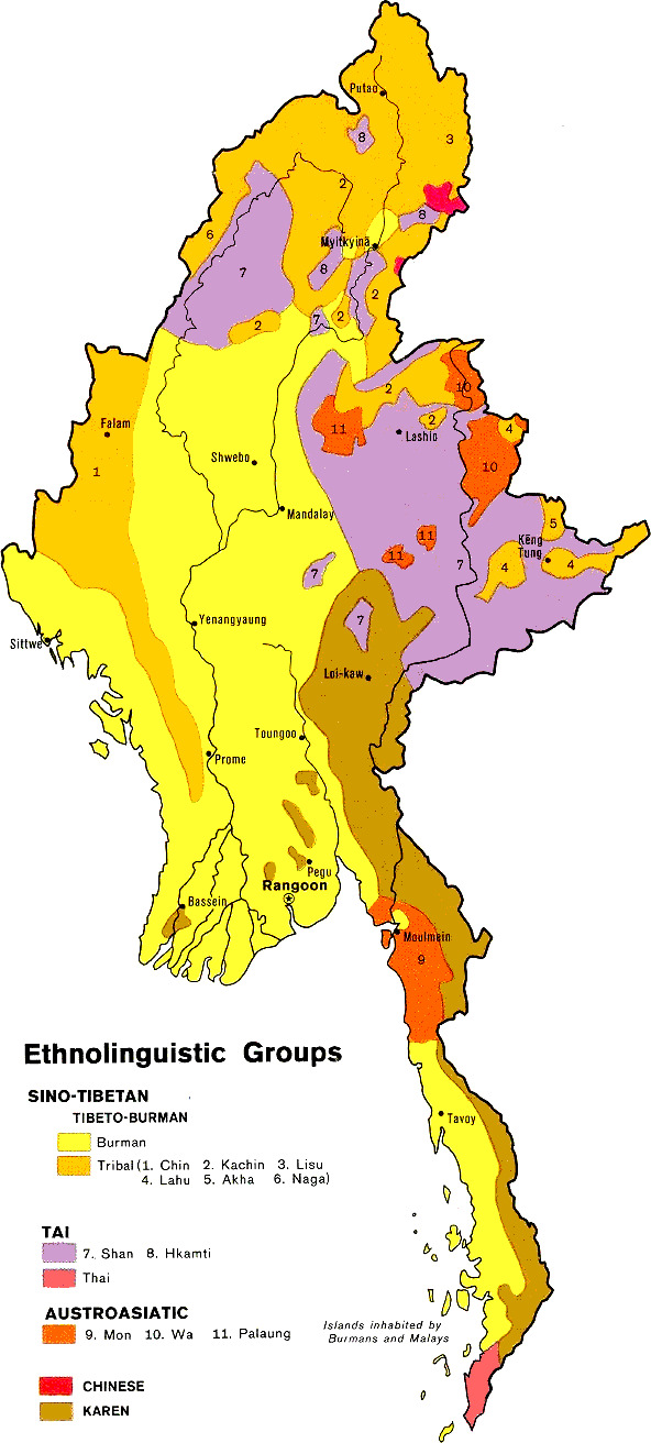
Ethnolinguistic map of Myanmar found [1] Ethnic groups:
Place names:
|
|||
| Date | ||||
| Source | Courtesy of the University of Texas Libraries, The University of Texas at Austin | |||
| Author | ||||
| Permission (Reusing this file) |
|

File history
Click on a date/time to view the file as it appeared at that time.
| Date/Time | Thumbnail | Dimensions | User | Comment | |
|---|---|---|---|---|---|
| current | 20:27, 28 May 2011 | | 592 × 1,312 (266 KB) | Haabet (talk | contribs) | colours |
| 18:29, 15 August 2006 |  | 1,056 × 1,361 (169 KB) | Hintha (talk | contribs) | {{Information |Description=Ethnolinguistic map of Myanmar found [http://www.lib.utexas.edu/maps/burma.html] |Source=Courtesy of the University of Texas Libraries, The University of Texas at Austin |Date=1972 |Author= |Permission={{PD-USGov-CIA}}<br/> |oth |
You cannot overwrite this file.
File usage on Commons
The following 2 pages use this file:
File usage on other wikis
The following other wikis use this file:
- Usage on azb.wikipedia.org
- Usage on bn.wikipedia.org
- Usage on el.wikipedia.org
- Usage on en.wikipedia.org
- Usage on en.wikinews.org
- Usage on en.wikivoyage.org
- Usage on fi.wikipedia.org
- Usage on it.wikipedia.org
- Usage on kk.wikipedia.org
- Usage on lt.wikipedia.org
- Usage on sco.wikipedia.org
- Usage on sq.wikipedia.org
- Usage on th.wikipedia.org