File:Panství habsburské v XVI. století.jpg
Original file (952 × 823 pixels, file size: 191 KB, MIME type: image/jpeg)
Captions
Captions
Summary
[edit]
| Description |
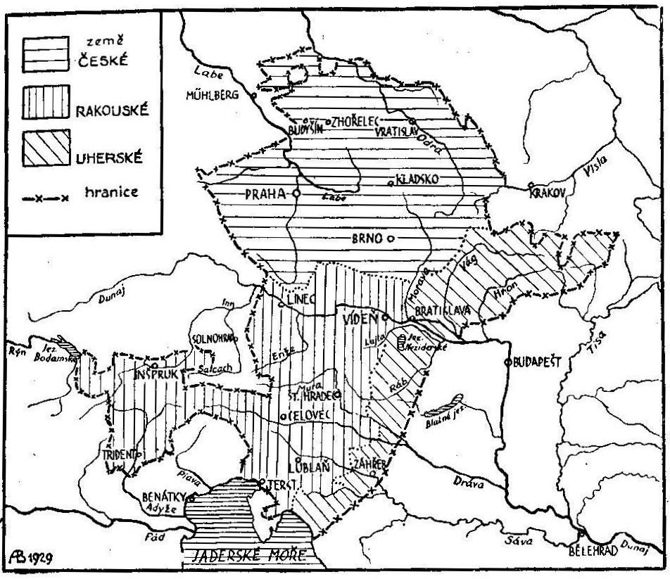
Čeština: Mapa panství Habsburků v 16. století.
English: Map showing territories ruled by the Habsburgs in the 16th century. (1. Czech lands, 2. Austrian lands and 3. Hungarian lands.) |
| Date | |
| Source | Doc. Dr. Jaroslav Prokeš: Obrázkové dějiny naší samostatnosti, díl první, Nakladatelství České grafické unie a.s., Praha, 1931, vydání druhé |
| Author | A. Blaschka |
Licensing
[edit]
|
This is a faithful photographic reproduction of a two-dimensional, public domain work of art. The work of art itself is in the public domain for the following reason:
The official position taken by the Wikimedia Foundation is that "faithful reproductions of two-dimensional public domain works of art are public domain". This photographic reproduction is therefore also considered to be in the public domain in the United States. In other jurisdictions, re-use of this content may be restricted; see Reuse of PD-Art photographs for details. {{PD-Art}} template without license parameter: please specify why the underlying work is public domain in both the source country and the United States
(Usage: {{PD-Art|1=|deathyear=''year of author's death''|country=''source country''}}, where parameter 1= can be PD-old-auto, PD-old-auto-expired, PD-old-auto-1996, PD-old-100 or similar. See Commons:Multi-license copyright tags for more information.) | ||||
File history
Click on a date/time to view the file as it appeared at that time.
| Date/Time | Thumbnail | Dimensions | User | Comment | |
|---|---|---|---|---|---|
| current | 21:13, 14 November 2009 | | 952 × 823 (191 KB) | Alfie983 (talk | contribs) | {{Information |Description={{cs|1=Mapa panství Habsburků v 16. století.)}} {{en|1=Map showing territories ruled by the Habsburgs in the 16th century. (1. Czech lands, 2. Austrian lands and 3. Hungarian lands.)}} |Source=Doc. Dr. Jaroslav Prokeš: Obrá |
You cannot overwrite this file.
File usage on Commons
The following 2 pages use this file:
File usage on other wikis
The following other wikis use this file:
- Usage on cs.wikipedia.org
- Usage on en.wikipedia.org
Metadata
- Maps of the history of Czechia
- Maps of the history of Austria
- Maps of the history of Hungary (1526–1700)
- Maps of the history of Slovakia
- Czech-language maps
- Old maps of Czechia
- Maps of the history of Silesia
- Old maps of Austria
- Old maps of Slovakia
- Old maps of Hungary
- Old maps of Croatia
- Maps of the history of Croatia (1526–1918)