File:RegnoItalia1861.png
Jump to navigation
Jump to search
No higher resolution available.
RegnoItalia1861.png (387 × 387 pixels, file size: 6 KB, MIME type: image/png)
Captions
Captions
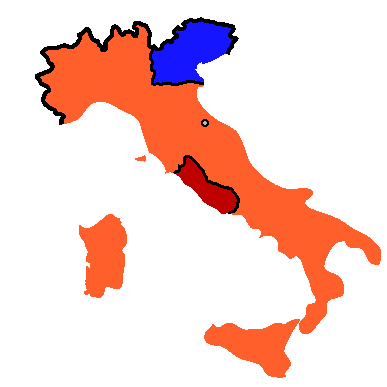
Italian peninsula in 1864
Summary
[edit]
Il Regno d'Italia nel 1861 dopo la spedizione dei Mille. Map created by Pdn.
After the Expedition of the Thousand

|
This historical map image could be re-created using vector graphics as an SVG file. This has several advantages; see Commons:Media for cleanup for more information. If an SVG form of this image is available, please upload it and afterwards replace this template with
{{vector version available|new image name}}.
It is recommended to name the SVG file “RegnoItalia1861.svg”—then the template Vector version available (or Vva) does not need the new image name parameter. |
Licensing
[edit]
| This file is licensed under the Creative Commons Attribution-Share Alike 3.0 Unported license. Subject to disclaimers. | ||
| ||
| This licensing tag was added to this file as part of the GFDL licensing update. |

|
Permission is granted to copy, distribute and/or modify this document under the terms of the GNU Free Documentation License, Version 1.2 or any later version published by the Free Software Foundation; with no Invariant Sections, no Front-Cover Texts, and no Back-Cover Texts. A copy of the license is included in the section entitled GNU Free Documentation License. Subject to disclaimers. |
File history
Click on a date/time to view the file as it appeared at that time.
| Date/Time | Thumbnail | Dimensions | User | Comment | |
|---|---|---|---|---|---|
| current | 21:57, 12 January 2014 | | 387 × 387 (6 KB) | Maps & Lucy (talk | contribs) | Clearer and sharper version |
| 08:19, 18 October 2006 |  | 1,124 × 1,330 (116 KB) | Electionworld (talk | contribs) | Gli Stati Italiani nel 1859 prima dell'unificazione: in arancio il Regno di Sardegna, in giallo il Regno delle Due Sicilie, in rosso lo Stato Pontificio, in blu il Regno Lombardo-Veneto e in verde il Granducato di Toscana e i Ducati di Parma e Modena Map |
You cannot overwrite this file.
File usage on Commons
The following 2 pages use this file:
File usage on other wikis
The following other wikis use this file:
- Usage on ar.wikipedia.org
- Usage on be.wikipedia.org
- Usage on da.wikipedia.org
- Usage on el.wikipedia.org
- Usage on en.wikipedia.org
- Usage on et.wikipedia.org
- Usage on fa.wikipedia.org
- Usage on fr.wikipedia.org
- Usage on ga.wikipedia.org
- Usage on hi.wikipedia.org
- Usage on hr.wikipedia.org
- Usage on it.wikipedia.org
- Usage on ja.wikipedia.org
- Usage on ka.wikipedia.org
- Usage on ko.wikipedia.org
- Usage on mk.wikipedia.org
- Usage on ms.wikipedia.org
- Usage on nn.wikipedia.org
- Usage on no.wikipedia.org
- Usage on pl.wikipedia.org
- Usage on pnb.wikipedia.org
- Usage on pt.wikipedia.org
- Usage on ro.wikipedia.org
- Usage on ru.wikipedia.org
- Usage on sl.wikipedia.org
- Usage on sw.wikipedia.org
- Usage on ta.wikipedia.org
- Usage on th.wikipedia.org
- Usage on ur.wikipedia.org