File:Slovakia map rivers and cities 2008-11-17.svg
Jump to navigation
Jump to search

Size of this PNG preview of this SVG file: 800 × 413 pixels. Other resolutions: 320 × 165 pixels | 640 × 330 pixels | 1,024 × 529 pixels | 1,280 × 661 pixels | 2,560 × 1,322 pixels | 1,220 × 630 pixels.
Original file (SVG file, nominally 1,220 × 630 pixels, file size: 225 KB)
Captions
Captions
Add a one-line explanation of what this file represents
This W3C-unspecified vector image was created with Inkscape .
W3C-validity not checked.
| Description |
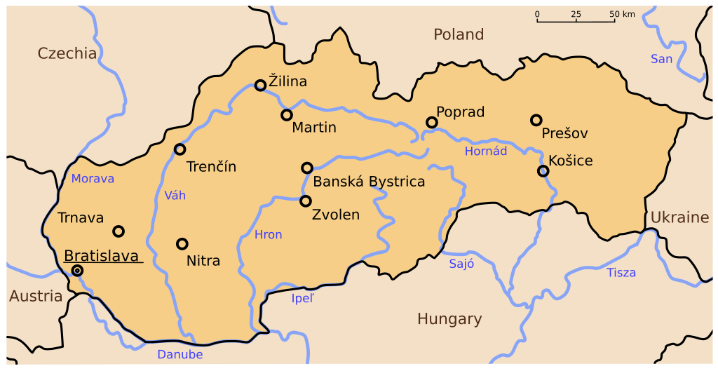
English: vectorized map of Slovakia with rivers and cities
Deutsch: vektorisierte Karte der Slowakei mit Städten und Flüssen |
| Date | (UTC) |
| Source | |
| Author |
|
| Other versions |
|


| This is a retouched picture, which means that it has been digitally altered from its original version. Modifications: cities and rivers added. The original can be viewed here: Slovakia clear map 2008-11-17.svg:
|
I, the copyright holder of this work, hereby publish it under the following licenses:
This file is licensed under the Creative Commons Attribution-Share Alike 3.0 Unported, 2.5 Generic, 2.0 Generic and 1.0 Generic license.
- You are free:
- to share – to copy, distribute and transmit the work
- to remix – to adapt the work
- Under the following conditions:
- attribution – You must give appropriate credit, provide a link to the license, and indicate if changes were made. You may do so in any reasonable manner, but not in any way that suggests the licensor endorses you or your use.
- share alike – If you remix, transform, or build upon the material, you must distribute your contributions under the same or compatible license as the original.

|
Permission is granted to copy, distribute and/or modify this document under the terms of the GNU Free Documentation License, Version 1.2 or any later version published by the Free Software Foundation; with no Invariant Sections, no Front-Cover Texts, and no Back-Cover Texts. A copy of the license is included in the section entitled GNU Free Documentation License. |
You may select the license of your choice.
Original upload log
[edit]
This image is a derivative work of the following images:
- Image:Slovakia_clear_map_2008-11-17.svg licensed with Cc-by-sa-3.0,2.5,2.0,1.0, GFDL
- 2008-11-17T19:34:48Z Henry Mühlpfordt 1220x630 (104714 Bytes) {{Created with Inkscape}} {{Information |Description=From Cia Factbook |Source=*[[:Image:Slovakia-map.png|]] |Date=2008-11-17 19:27 (UTC) |Author=*derivative work: ~~~ *[[:Image:Slovakia-map.png|]]: United States Central Inte
Uploaded with derivativeFX
File history
Click on a date/time to view the file as it appeared at that time.
| Date/Time | Thumbnail | Dimensions | User | Comment | |
|---|---|---|---|---|---|
| current | 22:24, 31 May 2021 | | 1,220 × 630 (225 KB) | Martin Tauchman (talk | contribs) | Geographical name of Czechia |
| 22:04, 17 November 2008 |  | 1,220 × 630 (224 KB) | Wimox (talk | contribs) | {{Information |Description= |Source= |Date= |Author= |Permission= |other_versions= }} | |
| 22:01, 17 November 2008 |  | 1,220 × 630 (224 KB) | Wimox (talk | contribs) | {{Information |Description= |Source= |Date= |Author= |Permission= |other_versions= }} | |
| 21:58, 17 November 2008 |  | 1,220 × 630 (224 KB) | Wimox (talk | contribs) | {{Information |Description= |Source= |Date= |Author= |Permission= |other_versions= }} | |
| 21:57, 17 November 2008 |  | 1,220 × 630 (102 KB) | Wimox (talk | contribs) | {{Information |Description= |Source= |Date= |Author= |Permission= |other_versions= }} | |
| 21:37, 17 November 2008 |  | 1,220 × 630 (224 KB) | Wimox (talk | contribs) | {{Information |Description= |Source= |Date= |Author= |Permission= |other_versions= }} | |
| 21:27, 17 November 2008 |  | 1,220 × 630 (245 KB) | Wimox (talk | contribs) | {{Information |Description= |Source= |Date= |Author= |Permission= |other_versions= }} | |
| 21:14, 17 November 2008 |  | 1,220 × 630 (233 KB) | Wimox (talk | contribs) | {{Information |Description= |Source= |Date= |Author= |Permission= |other_versions= }} | |
| 21:11, 17 November 2008 |  | 1,220 × 630 (235 KB) | Wimox (talk | contribs) | {{Information |Description= |Source= |Date= |Author= |Permission= |other_versions= }} | |
| 19:55, 17 November 2008 |  | 1,220 × 630 (233 KB) | Wimox (talk | contribs) | {{Information |Description=From Cia Factbook |Source=*Image:Slovakia_clear_map_2008-11-17.svg |Date=2008-11-17 19:52 (UTC) |Author=*derivative work: ~~~ *Image:Slovakia_clear_map_2008-11-17.svg: *derivative work: [[User:Mastermolch|Henry Mühl |
You cannot overwrite this file.
File usage on Commons
The following 7 pages use this file:
File usage on other wikis
The following other wikis use this file:
- Usage on ca.wikipedia.org
- Usage on de.wikipedia.org
- Usage on pl.wikipedia.org
- Usage on rm.wikipedia.org
- Usage on www.wikidata.org