File:Turkmenistan districts.png
Jump to navigation
Jump to search

Size of this preview: 800 × 530 pixels. Other resolutions: 320 × 212 pixels | 640 × 424 pixels | 1,024 × 679 pixels | 1,281 × 849 pixels.
Original file (1,281 × 849 pixels, file size: 30 KB, MIME type: image/png)
Captions
Captions
Add a one-line explanation of what this file represents
Summary
[edit]
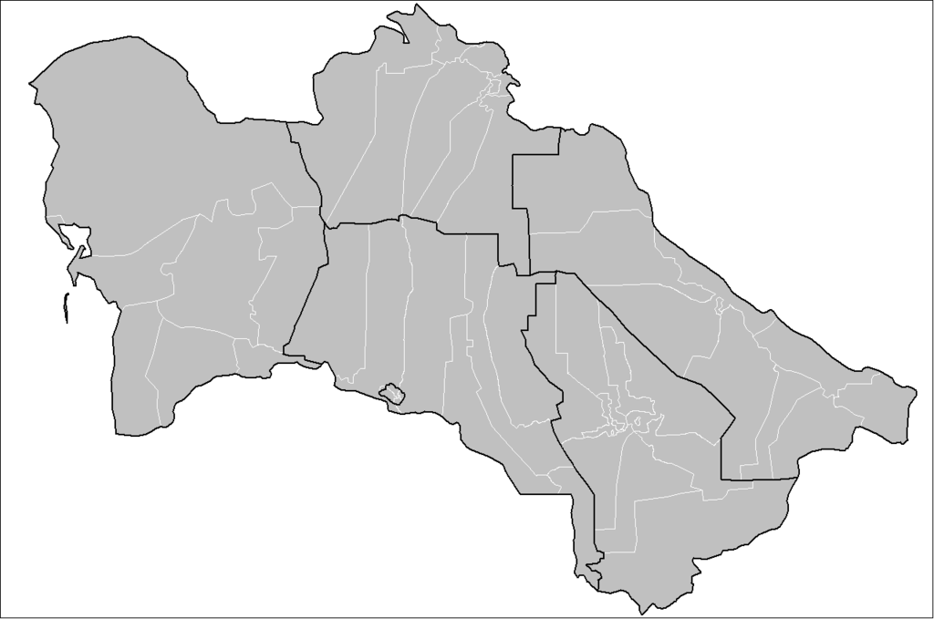
| Description | Map of the districts of Turkmenistan. Created by Rarelibra 21:48, 30 May 2007 (UTC) for public domain use, using MapInfo Professional v8.5 and various mapping resources. |
| Date | 30 May 2007 (original upload date) |
| Source | No machine-readable source provided. Own work assumed (based on copyright claims). |
| Author | No machine-readable author provided. Rarelibra assumed (based on copyright claims). |
Licensing
[edit]
| I, the copyright holder of this work, release this work into the public domain. This applies worldwide. In some countries this may not be legally possible; if so: I grant anyone the right to use this work for any purpose, without any conditions, unless such conditions are required by law. |
File history
Click on a date/time to view the file as it appeared at that time.
| Date/Time | Thumbnail | Dimensions | User | Comment | |
|---|---|---|---|---|---|
| current | 16:03, 17 April 2023 | | 1,281 × 849 (30 KB) | BasilLeaf (talk | contribs) | update, Balkan Region |
| 20:30, 7 April 2023 |  | 1,281 × 849 (30 KB) | BasilLeaf (talk | contribs) | update, Dashoguz Wilayat | |
| 16:19, 5 April 2023 |  | 1,281 × 849 (31 KB) | BasilLeaf (talk | contribs) | Lebap Region update (as of April 2023) | |
| 07:19, 29 March 2023 |  | 1,281 × 849 (43 KB) | BasilLeaf (talk | contribs) | Ahal WelayatynynTejen we Babadayhan etraplary we Mary Welayatynyn Murgap we Altyn Sahra we Oguzhan etraplary | |
| 04:53, 28 March 2023 |  | 1,281 × 849 (43 KB) | BasilLeaf (talk | contribs) | Ahal Welayet update | |
| 03:01, 13 June 2007 |  | 1,281 × 849 (13 KB) | Andrew pmk~commonswiki (talk | contribs) | optimize png | |
| 21:48, 30 May 2007 |  | 1,281 × 849 (25 KB) | Rarelibra (talk | contribs) | Map of the districts of Turkmenistan. Created by ~~~~ for public domain use, using MapInfo Professional v8.5 and various mapping resources. |
You cannot overwrite this file.
File usage on Commons
The following page uses this file:
File usage on other wikis
The following other wikis use this file:
- Usage on en.wikipedia.org
- Usage on es.wikipedia.org
- Usage on fa.wikipedia.org
- Usage on kk.wikipedia.org
- Usage on ms.wikipedia.org
- Usage on pnb.wikipedia.org
- Usage on ro.wikipedia.org
- Usage on ru.wikipedia.org
- Usage on ru.wikinews.org
- Usage on tr.wikipedia.org
- Usage on tt.wikipedia.org
- Usage on ur.wikipedia.org
- Usage on zh.wikipedia.org