Category:Locator maps of prefectures of the Central African Republic
Jump to navigation
Jump to search
Subcategories
This category has only the following subcategory.
Media in category "Locator maps of prefectures of the Central African Republic"
The following 107 files are in this category, out of 107 total.
-
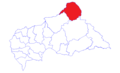
 Bambingui-Bangoran (Central African Republic).svg 1,606 × 1,110; 499 KB
-
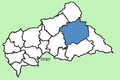
 Bamingui-Bangoran Prefecture Central African Republic locator.png 423 × 281; 27 KB
-
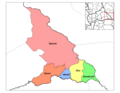
 Bamingui-Bangoran sub-prefectures.png 1,056 × 816; 23 KB
-
 Bangui Autonomous Commune Central African Republic locator.png 423 × 281; 30 KB
-
 Basse-Kotto (Central African Republic).svg 1,606 × 1,110; 463 KB
-
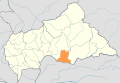
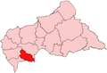
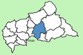
 Basse-Kotto Prefecture Central African Republic locator.png 423 × 281; 27 KB
-
 Basse-Kotto sub-prefectures.png 1,056 × 816; 32 KB
-
 CAR map of prefectures.svg 1,606 × 1,110; 596 KB
-
 CAR prefectures numbers.png 423 × 281; 13 KB
-
 CAR prefectures.png 423 × 281; 18 KB
-
 CAR-BaminguiBangoran.png 611 × 418; 9 KB
-
 CAR-Bangui.PNG 611 × 418; 14 KB
-
 CAR-BasseKotto.png 611 × 418; 9 KB
-
 CAR-HauteKotto.png 611 × 418; 9 KB
-
 CAR-HautMbomou.png 611 × 418; 9 KB
-
 CAR-Kemo.png 611 × 418; 9 KB
-
 CAR-Lobaye.png 611 × 418; 9 KB
-
 CAR-MambereKadei.png 611 × 418; 9 KB
-
 CAR-Mbomou.png 611 × 418; 9 KB
-
 CAR-NanaGrebizi.png 611 × 418; 9 KB
-
 CAR-NanaMambere.png 611 × 418; 9 KB
-
 CAR-OmbellaMpoko.png 611 × 418; 9 KB
-
 CAR-Ouaka.png 611 × 418; 9 KB
-
 CAR-Ouham.png 611 × 418; 9 KB
-
 CAR-OuhamPende.png 611 × 418; 9 KB
-
 CAR-SanghaMbaere.png 611 × 418; 9 KB
-
 CAR-Vakaga.png 611 × 418; 9 KB
-
 Central African Republic prefectures blank.png 2,000 × 1,366; 21 KB
-
 Central African Republic sub-prefectures.png 1,025 × 623; 19 KB
-
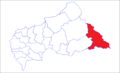
 Haut-Mbomou (Central African Republic).svg 1,606 × 1,110; 473 KB
-
 Haut-Mbomou Prefecture Central African Republic locator.png 423 × 281; 27 KB
-
 Haut-Mbomou sub-prefectures.png 1,056 × 816; 31 KB
-
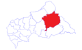
 Haute-Kotto (Central African Republic).svg 1,606 × 1,110; 480 KB
-
 Haute-Kotto Prefecture Central African Republic locator.png 423 × 281; 27 KB
-
 Haute-Kotto sub-prefectures.png 1,056 × 816; 25 KB
-
 Kemo sub-prefectures.png 1,056 × 816; 25 KB
-
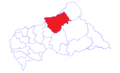
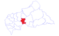
 Kémo (Central African Republic).svg 1,606 × 1,110; 459 KB
-
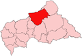
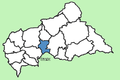 Kémo Prefecture Central African Republic locator.png 423 × 281; 28 KB
-
 Lobaye (Central African Republic).svg 1,606 × 1,110; 468 KB
-
 Lobaye Prefecture Central African Republic locator.png 423 × 281; 27 KB
-
 Lobaye sub-prefectures.png 1,056 × 816; 34 KB
-
 Localisation de Berbérati.png 425 × 596; 114 KB
-
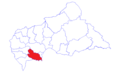
 Mambere-Kadei (Central African Republic).svg 1,606 × 1,110; 471 KB
-
 Mambere-Kadei sub-prefectures.png 1,056 × 816; 37 KB
-
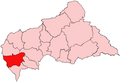
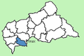
 Mambéré-Kadéï Prefecture Central African Republic locator.png 423 × 281; 27 KB
-
 Map of Bamingui-Bangoran 2021.png 1,025 × 623; 18 KB
-
 Map of Bangui 2021.png 1,025 × 623; 18 KB
-
 Map of Basse-Kotto 2021.png 1,025 × 623; 18 KB
-
 Map of Central African Republic prefectures 2021 (named).png 1,025 × 623; 35 KB
-
 Map of Haut-Mbomou 2021.png 1,025 × 623; 18 KB
-
 Map of Haute-Kotto 2021.png 1,025 × 623; 18 KB
-
 Map of Kémo 2021.png 1,025 × 623; 18 KB
-
 Map of Lim-Pendé 2021.png 1,025 × 623; 18 KB
-
 Map of Lobaye 2021.png 1,025 × 623; 18 KB
-
 Map of Mambéré 2021.png 1,025 × 623; 18 KB
-
 Map of Mambéré-Kadéï 2021.png 1,025 × 623; 18 KB
-
 Map of Mbomou 2021.png 1,025 × 623; 18 KB
-
 Map of Nana-Grébizi 2021.png 1,025 × 623; 18 KB
-
 Map of Nana-Mambéré 2021.png 1,025 × 623; 18 KB
-
 Map of Ombella-M'Poko 2021.png 1,025 × 623; 18 KB
-
 Map of Ouaka 2021.png 1,025 × 623; 18 KB
-
 Map of Ouham 2021.png 1,025 × 623; 18 KB
-
 Map of Ouham-Fafa 2021.png 1,025 × 623; 18 KB
-
 Map of Ouham-Pendé 2021.png 1,025 × 623; 18 KB
-
 Map of Sangha-Mbaéré 2021.png 1,025 × 623; 18 KB
-
 Map of Vakaga 2021.png 1,025 × 623; 18 KB
-
 Mbomou (Central African Republic).svg 1,606 × 1,110; 472 KB
-
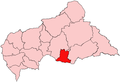
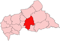
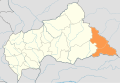
 Mbomou Prefecture Central African Republic locator.png 423 × 281; 28 KB
-
 Mbomou sub-prefectures.png 1,056 × 816; 31 KB
-
 Nana-Grebizi (Central African Republic).svg 1,606 × 1,110; 470 KB
-
 Nana-Grebizi sub-prefectures.png 1,056 × 816; 21 KB
-
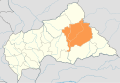
 Nana-Grébizi Prefecture Central African Republic locator.png 423 × 281; 28 KB
-
 Nana-Mambere sub-prefectures.png 1,056 × 816; 28 KB
-
 Nana-Mambéré (Central African Republic).svg 1,606 × 1,110; 465 KB
-
 Nana-Mambéré Prefecture Central African Republic locator.png 423 × 281; 28 KB
-
 Ombella-M'Poko Prefecture Central African Republic locator.png 423 × 281; 27 KB
-
 Ombella-M'Poko sub-prefectures.png 1,056 × 816; 32 KB
-
 Ombella-Mpoko (Central African Republic).svg 1,606 × 1,110; 467 KB
-
 Ouaka (Central African Republic).svg 1,606 × 1,110; 474 KB
-
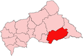
 Ouaka Prefecture Central African Republic locator.png 423 × 281; 28 KB
-
 Ouaka sub-prefectures.png 1,056 × 816; 27 KB
-
 Ouham (Central African Republic).svg 1,606 × 1,110; 480 KB
-
 Ouham Prefecture Central African Republic locator.png 423 × 281; 27 KB
-
 Ouham sub-prefectures.png 1,056 × 816; 37 KB
-
 Ouham-Pende sub-prefectures.png 1,056 × 816; 32 KB
-
 Ouham-Pendé (Central African Republic).svg 1,606 × 1,110; 474 KB
-
 Ouham-Pendé Prefecture Central African Republic locator.png 423 × 281; 28 KB
-
 Sangha-Mbaere sub-prefectures.png 1,056 × 816; 25 KB
-
 Sangha-Mbaéré (Central African Republic).svg 1,606 × 1,110; 466 KB
-
 Sangha-Mbaéré Prefecture Central African Republic locator.png 423 × 281; 27 KB
-
 Vakaga (Central African Republic).svg 1,606 × 1,110; 466 KB
-
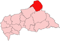
 Vakaga Prefecture Central African Republic locator.png 423 × 281; 27 KB
-
 Vakaga sub-prefectures.png 1,056 × 816; 23 KB
-
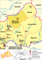 Zentralafrikanische-republik-karte-politisch-bamingui-bangoran.png 425 × 596; 141 KB
-
 Zentralafrikanische-republik-karte-politisch-basse-kotto.png 425 × 596; 141 KB
-
 Zentralafrikanische-republik-karte-politisch-haut-mbomou.png 425 × 596; 116 KB
-
 Zentralafrikanische-republik-karte-politisch-haute-kotto.png 425 × 596; 116 KB
-
 Zentralafrikanische-republik-karte-politisch-kemo.png 425 × 596; 141 KB
-
 Zentralafrikanische-republik-karte-politisch-lobaye.png 425 × 596; 165 KB
-
 Zentralafrikanische-republik-karte-politisch-mambere-kadei.png 425 × 596; 165 KB
-
 Zentralafrikanische-republik-karte-politisch-mbomou.png 425 × 596; 116 KB
-
 Zentralafrikanische-republik-karte-politisch-nana-grebizi.png 425 × 596; 141 KB
-
 Zentralafrikanische-republik-karte-politisch-nana-mambere.png 425 × 596; 165 KB
-
 Zentralafrikanische-republik-karte-politisch-ouham-pende.png 425 × 596; 165 KB
-
 Zentralafrikanische-republik-karte-politisch-ouham.png 425 × 596; 165 KB
-
 Zentralafrikanische-republik-karte-politisch-sangha-mbaere.png 425 × 596; 164 KB
-
 Zentralafrikanische-republik-karte-politisch-vakaga.png 425 × 596; 140 KB
.svg)


.svg)


.svg)


.svg)


.svg)

.svg)


.svg)


.png)


.svg)


.svg)


.svg)


.svg)
.svg)


.svg)


.svg)


.svg)

.svg)


