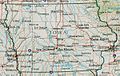
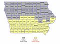
Category:Maps of Iowa
Jump to navigation
Jump to search
States of the United States: Alabama · Alaska · Arizona · Arkansas · California · Colorado · Connecticut · Delaware · Florida · Georgia · Hawaii · Idaho · Illinois · Indiana · Iowa · Kansas · Kentucky · Louisiana · Maine · Maryland · Massachusetts · Michigan · Minnesota · Mississippi · Missouri · Montana · Nebraska · Nevada · New Hampshire · New Jersey · New Mexico · New York · North Carolina · North Dakota · Ohio · Oklahoma · Oregon · Pennsylvania · Rhode Island · South Carolina · South Dakota · Tennessee · Texas · Utah · Vermont · Virginia · Washington · West Virginia · Wisconsin · Wyoming – Washington, D.C.
insular area of the United States: American Samoa · Guam · Northern Mariana Islands · Puerto Rico · United States Virgin Islands – United States Minor Outlying Islands: Baker Island · Howland Island · Jarvis Island · Johnston Atoll · Kingman Reef · Midway Atoll · Navassa Island · Palmyra Atoll · Wake Island
insular area of the United States: American Samoa · Guam · Northern Mariana Islands · Puerto Rico · United States Virgin Islands – United States Minor Outlying Islands: Baker Island · Howland Island · Jarvis Island · Johnston Atoll · Kingman Reef · Midway Atoll · Navassa Island · Palmyra Atoll · Wake Island
Wikimedia category | |||||
| Upload media | |||||
| Instance of | |||||
|---|---|---|---|---|---|
| Category combines topics | |||||
| Iowa | |||||
state of the United States of America    | |||||
| Pronunciation audio | |||||
| Instance of | |||||
| Part of | |||||
| Named after | |||||
| Location |
| ||||
| Located in or next to body of water | |||||
| Capital | |||||
| Legislative body | |||||
| Executive body | |||||
| Highest judicial authority |
| ||||
| Official language | |||||
| Anthem |
| ||||
| Head of government |
| ||||
| Present in work |
| ||||
| Inception |
| ||||
| Highest point |
| ||||
| Population |
| ||||
| Area |
| ||||
| Different from | |||||
| Maximum temperature record |
| ||||
| Minimum temperature record |
| ||||
| official website | |||||
 | |||||

Subcategories
This category has the following 29 subcategories, out of 29 total.
*
A
- Area code maps of Iowa (8 F)
B
- Bird's eye view maps of Iowa (4 F)
- Blank maps of Iowa (17 F)
C
D
- Districts of Iowa (1 F)
E
F
- Flag maps of Iowa (2 F)
G
H
L
- Location maps of Iowa (3 F)
N
- National Atlas maps of Iowa (3 F)
O
- OpenStreetMap maps of Iowa (2 F)
P
R
- Maps of rivers in Iowa (16 F)
- Rail transport maps of Iowa (8 F)
S
T
- Topographic maps of Iowa (3 F)
Media in category "Maps of Iowa"
The following 45 files are in this category, out of 45 total.
-
 1825 Prairie du Chien Line.jpg 1,275 × 1,650; 495 KB
-
 1984 Iowa Democratic delegation allocation by district.svg 602 × 411; 515 KB
-
 2020aug-derecho-storm-crop-overlay-usda-map.png 705 × 545; 406 KB
-
 335 of 'The history of Wapello County, Iowa ... Illustrated' (11075634404).jpg 1,112 × 671; 179 KB
-
 AmDiscoveryMap.jpg 300 × 211; 32 KB
-
 Andrew Yang Iowa Tour, January and February 2020.png 1,920 × 1,440; 466 KB
-
 DCI-Office-Map.png 1,650 × 1,154; 1.32 MB
-
 Eastern states endangered plants (1980) (21144144021).jpg 2,928 × 1,960; 675 KB
-
 Eastern-Iowa-Airport.jpg 570 × 334; 28 KB
-
 ECUSA Iowa.png 665 × 503; 10 KB
-
 Electric railway journal (1909) (14758075471).jpg 2,878 × 2,220; 1,013 KB
-
 Honeywarmap.png 600 × 382; 75 KB
-
 Iowa - NARA - 26335499.jpg 8,448 × 6,168; 9.52 MB
-
 Iowa 2020 Population Density.png 2,980 × 1,954; 679 KB
-
 Iowa BSA Councils.png 900 × 630; 71 KB
-
 Iowa congressional districts 1981 to 1991.svg 602 × 411; 515 KB
-
 Iowa DOT districts.png 1,000 × 655; 87 KB
-
 Iowa judicial districts map.png 1,000 × 655; 71 KB
-
 Iowa Köppen.png 6,300 × 6,419; 305 KB
-
 Iowa magnetic map.jpg 884 × 576; 598 KB
-
 Iowa neighbors.jpg 768 × 523; 30 KB
-
 Iowa population map.png 700 × 400; 106 KB
-
 Iowa rainfall.jpg 844 × 561; 67 KB
-
 Iowa ref 2001.jpg 600 × 381; 139 KB
-
 IowaRegions2012.png 800 × 524; 135 KB
-
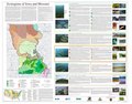 Level IV ecoregions, Iowa and Missouri.pdf 6,900 × 5,400; 5.66 MB
-
 Map of the State of Iowa - NARA - 25464222.jpg 10,496 × 8,396; 7.28 MB
-
 Map of the State of Iowa - NARA - 25464225.jpg 10,400 × 8,239; 7.29 MB
-
 Map of the State of Iowa - NARA - 25464228.jpg 10,752 × 7,220; 7.21 MB
-
 National Parks of Iowa (ee3f395f-1dd8-b71b-0bf7-5f189ad8f385).jpg 3,300 × 2,550; 4.65 MB
-
 National Weather Service (NWS) August 2020 Derecho Damage Survey Composite Map.png 1,804 × 1,204; 184 KB
-
 National Weather Service (NWS) Des Moines August 2020 Derecho Wind Estimate Map.jpg 1,392 × 863; 1.23 MB
-

-
 NorthernDistrictIowa.jpg 838 × 726; 107 KB
-
 Population density of Iowa counties (2020).jpg 6,053 × 3,558; 1.18 MB
-
 Raccoon Valley Metro Area.png 200 × 131; 13 KB
-
 RockIslandDistrictUSARCEmap.jpg 1,650 × 1,275; 766 KB
-
 Sioux01.png 1,286 × 1,445; 2.63 MB
-
 SouthernDistrictIowa.jpg 772 × 569; 60 KB
-
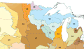 Upper Midwest ecoregions.gif 585 × 343; 29 KB
-
 Upper Midwest ecoregions.png 585 × 343; 125 KB
-
 Waterloo Creek Iowa.gif 600 × 450; 269 KB
-
 Western Corn Belt Plains ecoregion, Level III.png 403 × 334; 81 KB
-
 Wisconsin Arch and Michigan Basin.jpg 1,925 × 2,150; 1.19 MB
-
 WLF Plants.jpg 312 × 207; 35 KB


.jpg)


_(21144144021).jpg)


_(14758075471).jpg)


.jpg)
_August_2020_Derecho_Damage_Survey_Composite_Map.png)
_Des_Moines_August_2020_Derecho_Wind_Estimate_Map.jpg)
_Quad_Cities_August_2020_Derecho_Localized_Wind_Estimate_Map.png)

.jpg)


