Category:Maps of Saint Lucia
Jump to navigation
Jump to search
Wikimedia category | |||||
| Upload media | |||||
| Instance of | |||||
|---|---|---|---|---|---|
| Category combines topics | |||||
 | |||||
Subcategories
This category has the following 11 subcategories, out of 11 total.
C
E
- Election maps of Saint Lucia (20 F)
F
- Flag maps of Saint Lucia (4 F)
L
- Location maps of Saint Lucia (3 F)
M
- Map of Canaries Quarter (3 F)
O
S
T
V
- Visa maps of Saint Lucia (4 F)
Pages in category "Maps of Saint Lucia"
The following 2 pages are in this category, out of 2 total.
Media in category "Maps of Saint Lucia"
The following 20 files are in this category, out of 20 total.
-
 USGS Saint Lucia geologic map.png 1,312 × 590; 457 KB
-
 ECDM 20161130 Caribbean SW v2.pdf 1,625 × 1,125; 670 KB
-
 ECDM 20190827 Caribbean TC DORIAN.pdf 1,625 × 1,125; 674 KB
-
 ECDM 20200724 TC GONZALO.pdf 1,625 × 1,125; 854 KB
-
 ECDM 20210706 TC ELSA update.pdf 1,625 × 1,125; 1.01 MB
-
 FLII StLucia.png 673 × 766; 39 KB
-
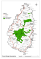 Forest administration and forest reserve in Saint Lucia.png 850 × 1,223; 280 KB
-
 Mapa suroeste de Santa Lucia.jpg 312 × 377; 15 KB
-
 PAT - Saint Lucia.gif 750 × 1,120; 61 KB
-
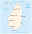
 Saint Lucia map.gif 330 × 353; 13 KB
-
 Saint lucia Population Density, 2000 (6172441792).jpg 2,324 × 3,161; 507 KB
-
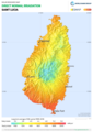 Saint-Lucia DNI Solar-resource-map GlobalSolarAtlas World-Bank-Esmap-Solargis.png 1,842 × 2,605; 624 KB
-
 Saint-Lucia GHI Solar-resource-map GlobalSolarAtlas World-Bank-Esmap-Solargis.png 1,842 × 2,605; 624 KB
-

-
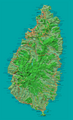
 SaintLucia2021OSM.png 3,345 × 5,636; 5.98 MB
-
 Santa Lucia-Mappa.gif 330 × 355; 7 KB
-
 St Lucia map.png 1,912 × 3,147; 4.21 MB
-
 St lucia twin pitons.png 450 × 497; 5 KB
-
 St-Lucia.JPG 1,348 × 1,706; 780 KB
-
 St. Lucia Population Density, 2000 (5457015323).jpg 2,497 × 3,194; 553 KB


.jpg)


.jpg)