Category:Maps of education
Jump to navigation
Jump to search
Subcategories
This category has the following 9 subcategories, out of 9 total.
Media in category "Maps of education"
The following 7 files are in this category, out of 7 total.
-
 BelarusHigherEducation2009.png 1,550 × 1,212; 144 KB
-
-
 Map showing educational institutes 2020.png 1,741 × 784; 846 KB
-
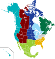 NACURH North American Regions.svg 512 × 547; 467 KB
-
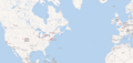
 Turkish Speaking Countries Undergraduate Scholarship Program.jpg 1,469 × 865; 400 KB
-
 Universidades españolas en América durante el periodo colonial.jpg 2,000 × 2,580; 1.1 MB
-
 Universidades españolas en el Siglo de Oro.jpg 3,651 × 1,450; 1.08 MB


