Category:Satellite pictures of forests
Jump to navigation
Jump to search
Subcategories
This category has only the following subcategory.
S
Media in category "Satellite pictures of forests"
The following 17 files are in this category, out of 17 total.
-
 Amazon rainforest ESA23215661.tiff 10,980 × 10,980; 215.71 MB
-
 Appalachian Mountains and Chesapeake Bay (MODIS).jpg 2,203 × 1,585; 1.58 MB
-
 Argentina Forest (ASTER).jpg 861 × 720; 96 KB
-
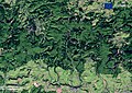 Belgium, Ardennes Forest.jpg 2,435 × 1,722; 2.64 MB
-
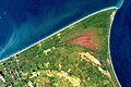
 Cordoba, Argentina (Guitar-shaped forest) (9430b9e2-a6fb-485a-be29-310f7d1276d7).tiff 6,522 × 6,524, 5 pages; 59.75 MB
-
 Daintree oli 2019248.jpg 720 × 790; 311 KB
-
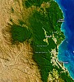
 Estuary of the Micay River, Colombia.jpg 3,508 × 2,512; 2.32 MB
-
 Everglades National Park on World Migratory Bird Day (Copernicus).jpg 4,008 × 2,543; 4.88 MB
-
 Great Smoky Mountains (MODIS).jpg 1,722 × 1,316; 1,004 KB
-
 Istanbul and Bosporus big.jpg 1,000 × 1,163; 1.64 MB
-
 Latvia, Slītere National Park.jpg 2,050 × 1,369; 3.7 MB
-
 Moulière forest (France), an experiment in climate change adaptation (Copernicus).jpg 4,410 × 2,541; 3.74 MB
-
 MuddusNationalParkSweden.jpg 3,634 × 2,175; 2.53 MB
-
 Sundarbans.jpg 7,200 × 4,800; 4 MB
-
 The Bialowieza Forest, Poland.jpg 3,508 × 2,540; 3.72 MB
-
 The reforestation of Costa Rica.jpg 4,008 × 2,543; 6.37 MB
-
 Vue aérienne de Puerto Maldonado.jpg 3,004 × 1,690; 2.48 MB
.jpg)
.jpg)


.jpg)
.jpg)


,_an_experiment_in_climate_change_adaptation_(Copernicus).jpg)


