File:Selsey-bill-hounds-mcz-boundary.pdf
Jump to navigation
Jump to search

Size of this JPG preview of this PDF file: 800 × 565 pixels. Other resolutions: 320 × 226 pixels | 640 × 452 pixels | 1,024 × 723 pixels | 1,280 × 904 pixels | 1,754 × 1,239 pixels.
Original file (1,754 × 1,239 pixels, file size: 529 KB, MIME type: application/pdf)
Captions
Captions
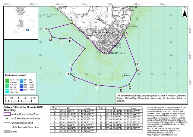
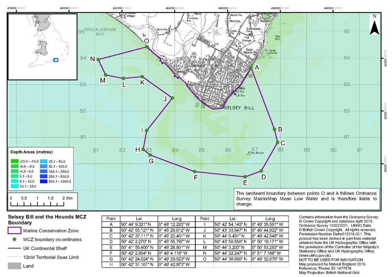
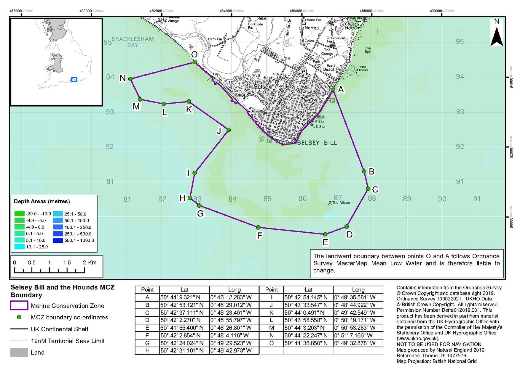
Selsey Bill and Hounds Marine Conservation Zone
Summary
[edit]| Description |
English: The boundary of the conservation area near the town of Selsey, West Sussex known as the Selsey Bill and Hounds Marine Conservation Area |
| Date | |
| Source | https://www.gov.uk/government/publications/marine-conservation-zones-selsey-bill-and-the-hounds |
| Author | Defra |
Licensing
[edit]_(St_Edwards_Crown).svg)
|
This file is licensed under the United Kingdom Open Government Licence v3.0. |
See also: Meta for information on usage on Wikimedia wikis.
|
File history
Click on a date/time to view the file as it appeared at that time.
| Date/Time | Thumbnail | Dimensions | User | Comment | |
|---|---|---|---|---|---|
| current | 19:34, 24 February 2024 |  | 1,754 × 1,239 (529 KB) | Wilfridselsey (talk | contribs) | Uploaded a work by Natural England from https://assets.publishing.service.gov.uk/media/5f566aa4d3bf7f4d72659300/selsey-bill-hounds-mcz-boundary.pdf with UploadWizard |
You cannot overwrite this file.
File usage on Commons
There are no pages that use this file.
File usage on other wikis
The following other wikis use this file:
- Usage on en.wikipedia.org